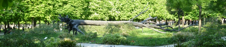
As I browsed the Paris1970 images described in my last blog, I spent a long time studying the photographs taken in the Bercy wine entrepot before its demolition. We’d visited the park that now occupies the space and it was something of a shock to see the community that had once existed there. People lived in this village within a city, as this image by an unidentified photographer attests. This was someone’s home. I don’t think I had fully appreciated that fact.
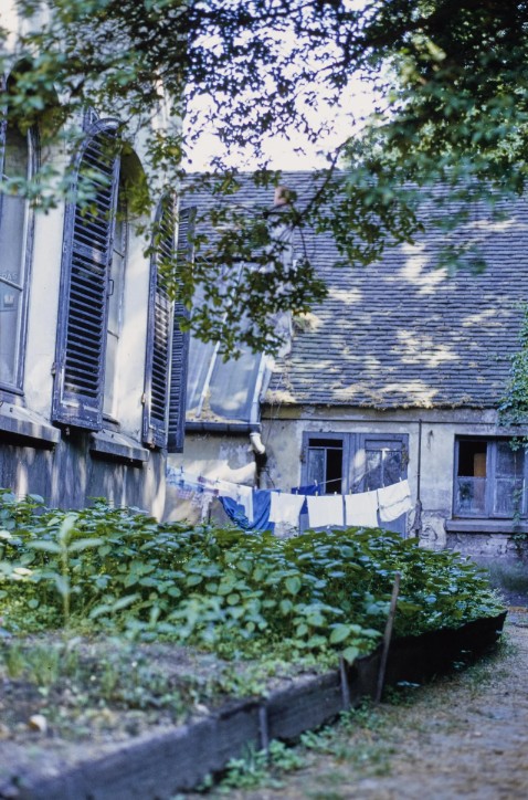
In 1970, the place was beginning to empty out, but life remained. It was no longer the bustling place of business it had once been, but there were people (including children) and vehicles and casks of wine evident, as well as laundry. This photograph is by Odette Bresard.
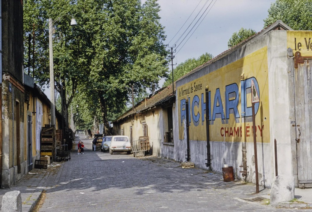
I wanted to know more about this vanished place. When and how did it develop? Why did its fortunes change?
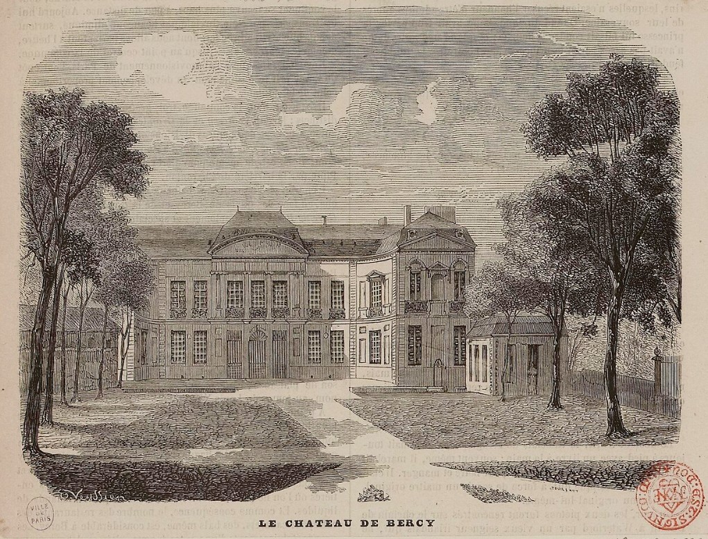
I started by looking at early maps and images of the area. In the 17th century, Bercy was a small commune outside the walls of Paris, with a chateau designed by François Le Vau (the younger brother of the more famous architect Louis le Vau) and a park with formal gardens running down to the river. The gardens were said to be the work of André Le Nôtre, who had also created the gardens at Versailles.
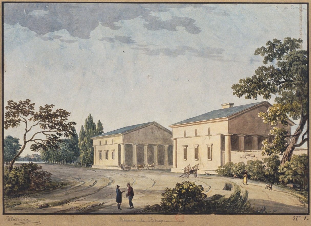
The chateau stood in solitary splendour for many years, but during the 18th century, other wealthy Parisians began to buy up lots for their own “country” residences, conveniently located just outside the city walls, past the barrière or customs gate of Bercy, shown below.
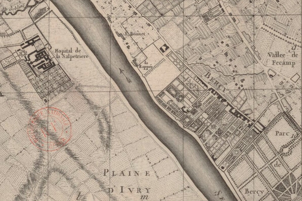
The large gardens were long and narrow so that all the properties had river access. The map shown below dates from 1749. The original park is still there, but the neighbours are starting to encroach.
The merchants of wine and spirits arrived in the late 18th and early 19th centuries. By 1813, a business directory of Paris, the Almanach du commerce de Paris, lists more than a dozen wine merchants in the commune, along with vinaigriers (vinegar makers) and a sugar refiner.
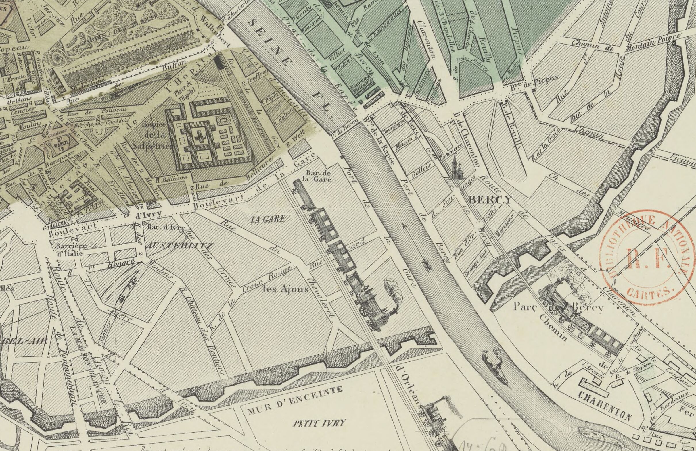
Back then, wine was brought to the entrepot in large casks, where it was bottled and then distributed. Over the course of the 19th century, the horse-drawn wagons were replaced by rail cars. I love this 1852 map by Bouquillard showing not only the rail lines, but pictures of trains in side view on them, in case you aren’t sure what the lines represent.
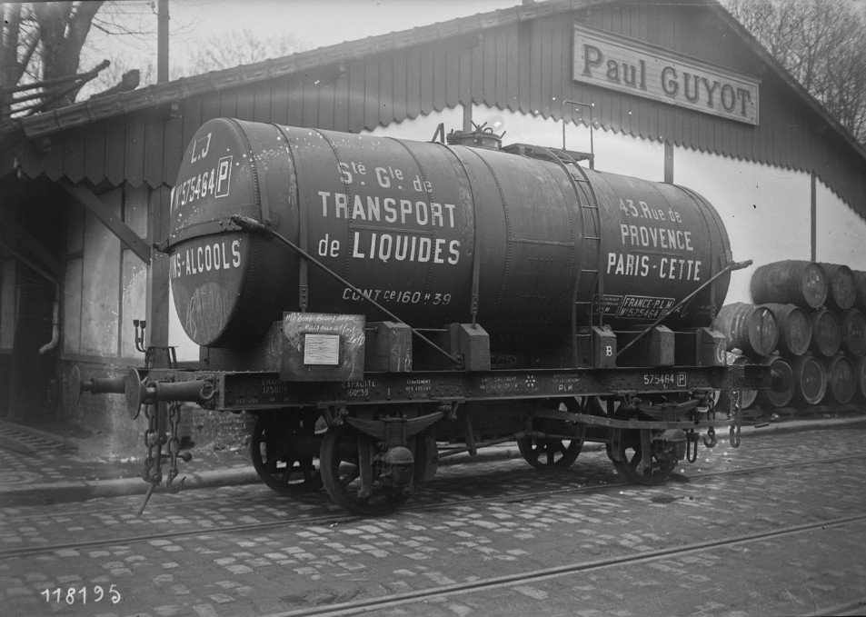
The Bercy site was criss-crossed with rail lines to move the wine to the premises of the particular owner. In this 1927 photo, the wine is being transported in a tanker rather than casks.
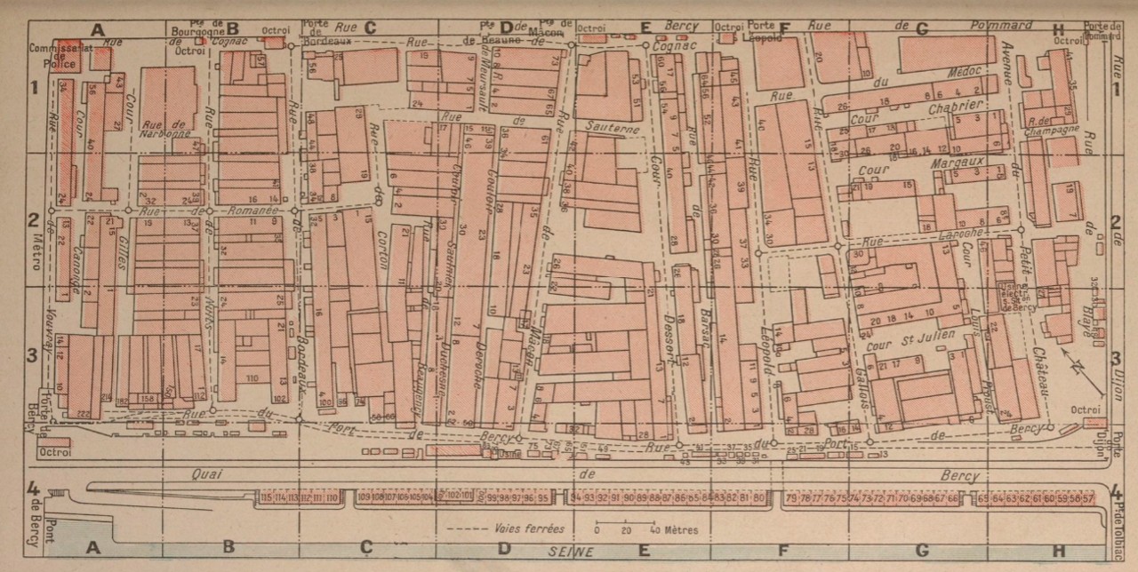
A map published the same year in a business directory shows the network of internal rail lines (the dotted lines). Notice the street names: Sauterne, Bordeaux, Margaux. Around the edges are the “octroi” or customs gates; this was a walled community, separated from the surrounding city, with its own police station (upper left) and electric power facility (lower right). Hardly surprising, given the quantity and nature of the goods stored there. This map shows about half of the site, which was cut in two by the rue de Dijon (shown here on the far right).
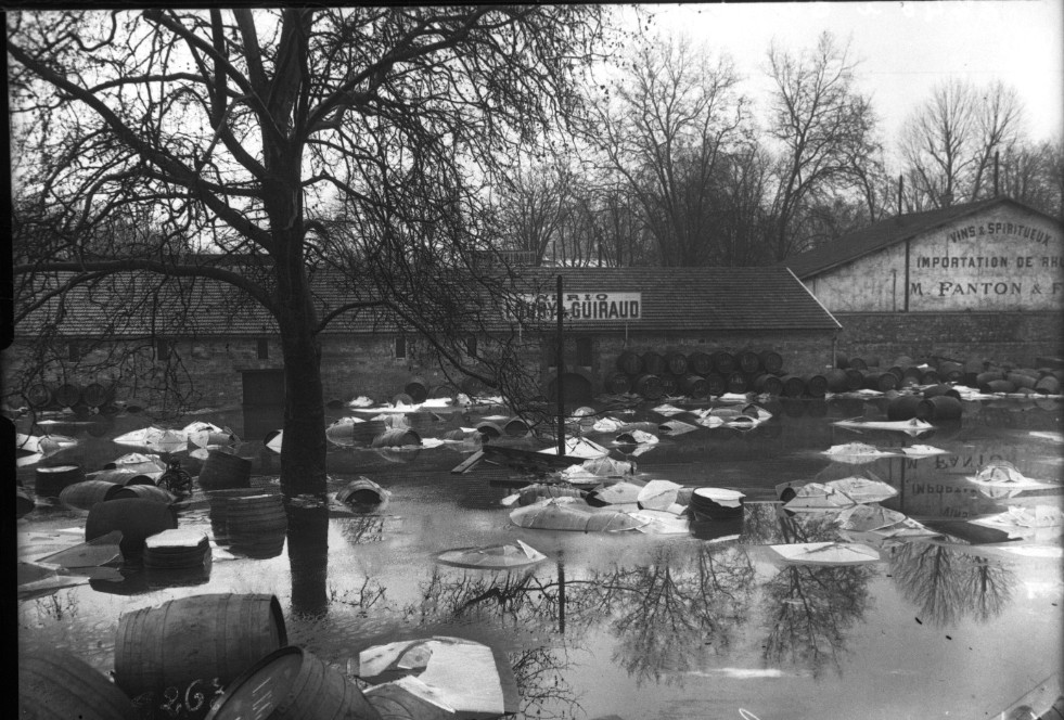
Wine also came by river, unloaded on the nearby quays. Like other sites close to the river, Bercy suffered during the 1910 flood. Thousands of litres of wine and spirits were contaminated.
Bercy recovered from that disaster, and from the First World War. There were big celebrations in 1933 for the end of Prohibition on the other side of the Atlantic. The entrepot escaped major damage in the Second World War, unlike the Halle aux Vins on the other side of the river, which suffered heavy bombing, and was not rebuilt (it became the Jussieu campus of the university).
But after the war, Bercy’s importance gradually started to wane, for a number of reasons. For one thing, more and more vintners were bottling their wine at the place of origin (“mis en bouteille au chateau”), removing one of the site’s functions. That was a natural evolution. But the decline was hastened by the deliberate actions of the City of Paris, which owned the land on which Bercy stood.
For years, the companies dealing in wine and spirits had leased land from the city. Starting in the 1960s, the City stopped renewing the leases, forcing the tenants to move out as their leases expired. As early as 1952, the place was becoming something of a quiet backwater, although business was still being carried on. In a book called Paris Vagabond, by Jean-Paul Clébert, written in 1952, I found a description of the area by a man accustomed to sleeping rough:
The wine warehouses of Bercy are a town in their own right. The gates, however, are always open and there is no trace of guards (indeed there is no sign barring access)… I have slept there several times without witnessing any kind of surveillance… But my greatest pleasure in Bercy comes from rambling about in the middle of the day, strolling down the little rustic streets paved with huge cobbles that you feel under your feet and following what seem to be tramlines until round a corner comes an exceedingly tall rail car; passing by houses that are simple farm buildings, their walls full of cracks and festooned with green creeping plants, beams with projecting hooks, gentle sloping tiled roofs, ogival double doors, short stone staircases with balustrades and square windows with solid wooden shutters; and going around great pudgy broad-trunked trees beneath which the odors of dead leaves, mown grass, damp stone, and the schoolyard hang in the air, whereas elsewhere the nose is assailed by scents of full-bodied wine, corks, new barrels and rubber hosepipes. All around the dwellings and warehouses the luckiest children in Paris play and chickens cluck and peck.*
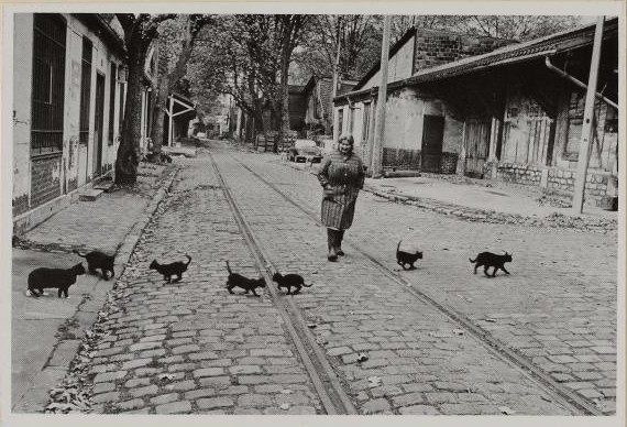
According to a book about the area, Bercy au fils du temps, by Lionel Mouraux,** the area became known as a picturesque spot in the 1970s, attracting photographers like Robert Doisneau, as well as the amateurs from the 1970 project. One Doisneau image from that time, featuring the many cats who roamed the area, was turned into a postcard.
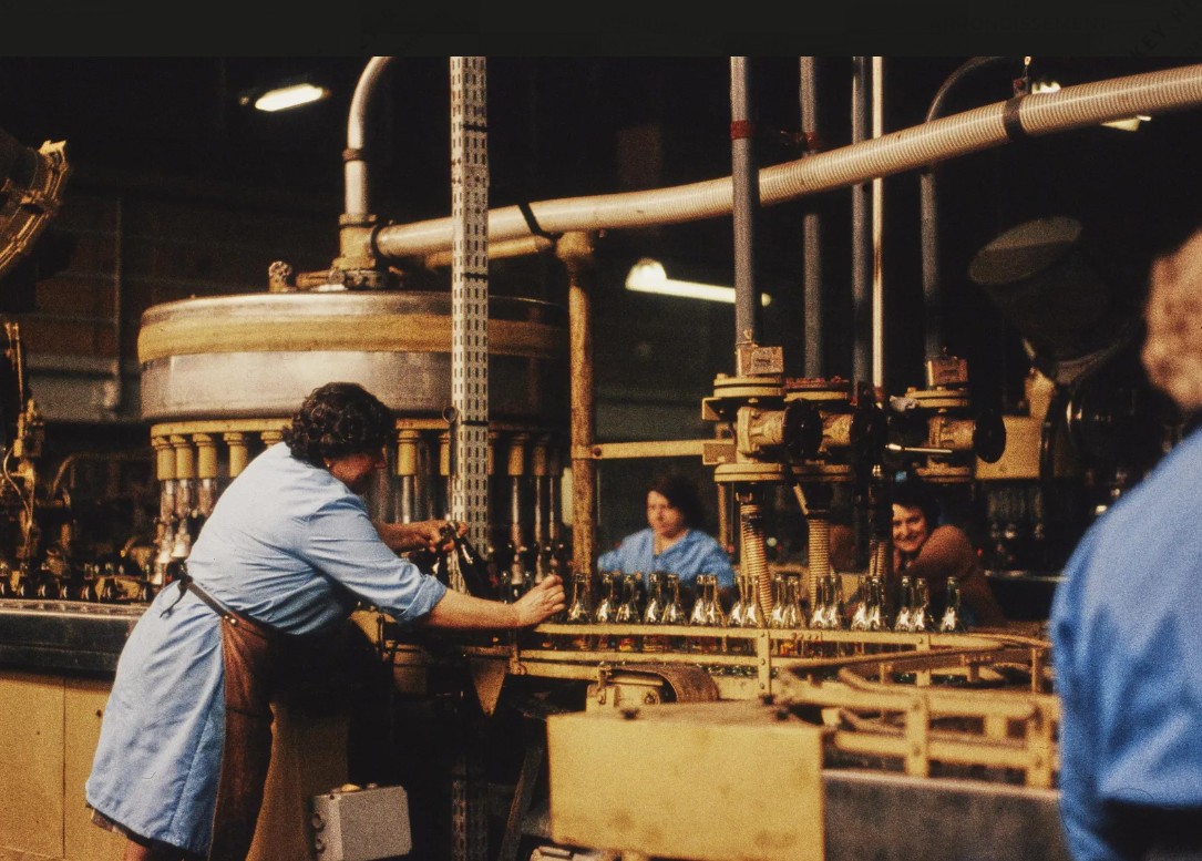
The book also notes that in 1970, there were still about 2,000 people employed in the entrepot. One of the Paris 1970 photographers, Andrée Naujac, captured several women at work in one of the remaining bottling plants.
But one by one the leases ran out and the businesses departed. The demolitions began in 1979. The unpopular demolition of Les Halles earlier that decade was still fresh in people’s minds, and some journalists protested in print, but Bercy was not as central nor quite as storied a site as Les Halles, and does not seem to have garnered the same kind of outcry.
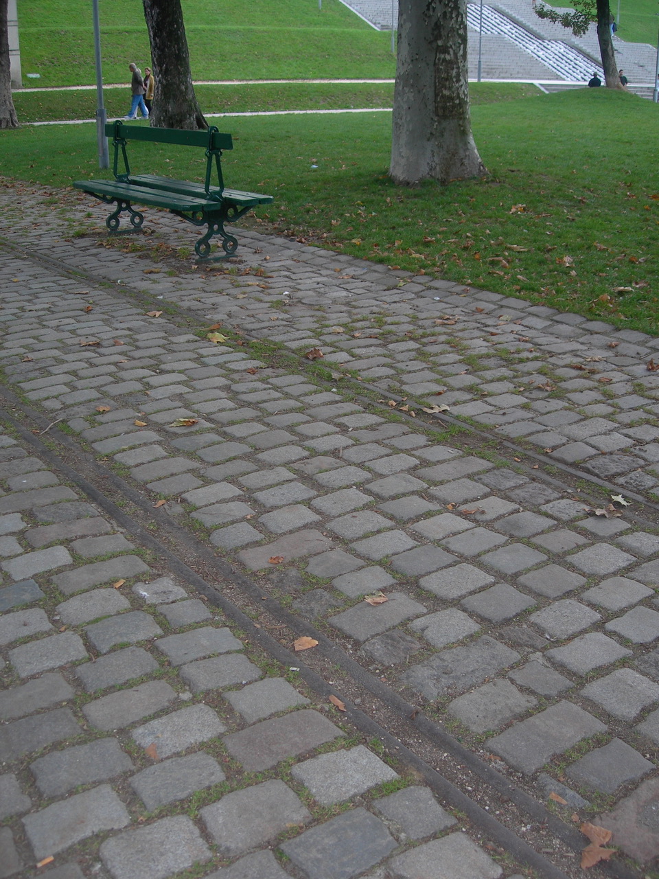
Today, a park covers the land, which retains a few vestiges of the vanished village – railway lines, some bits of masonry from one of the chateaux. The paths follow the original routes of some of the former village’s roads. This photograph, which Norman took some years ago, shows the rail lines that have been retained, and in the background, a lovely waterfall on the west side of the park.
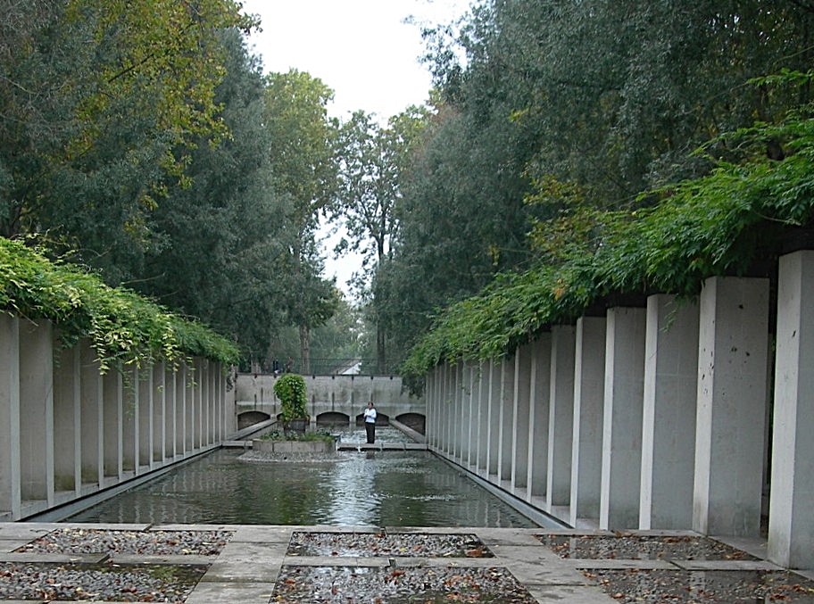
The vast park unfolds as you walk through it, with ponds and structures that hint at its past. (That’s me in the background of the photo below, by the way.)
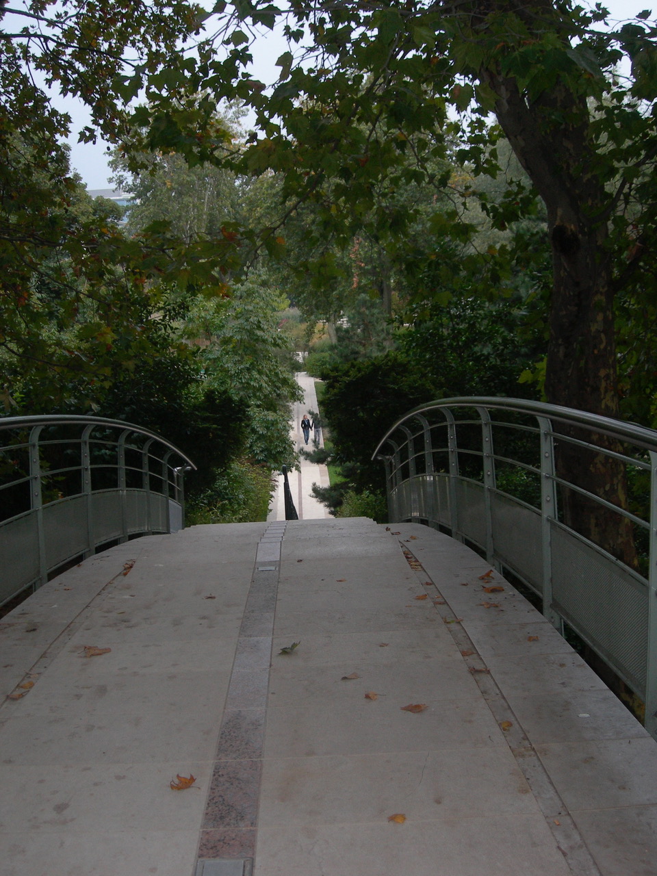
The rue de Dijon still divides the space into two halves, but a bridge crosses the street so you do not have to leave the park to go from one area to another.
It’s a delightful space, and the city needs open areas and greenery, but one cannot help feeling a twinge of nostalgia for the vanished village. So let us take a last look.
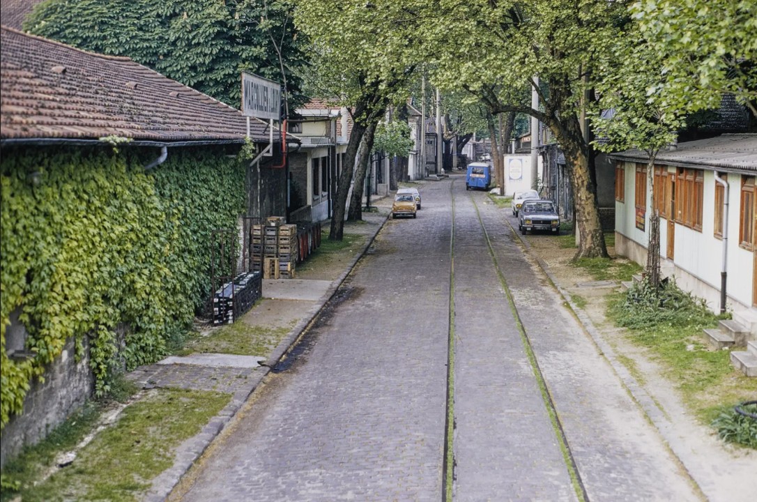
The two images below from Paris1970 are by the same unidentified photographer, who seems to have stood on the roof of a car or truck to get a high vantage point. Note the flowers in the window of what could easily be a farmhouse in a country village.
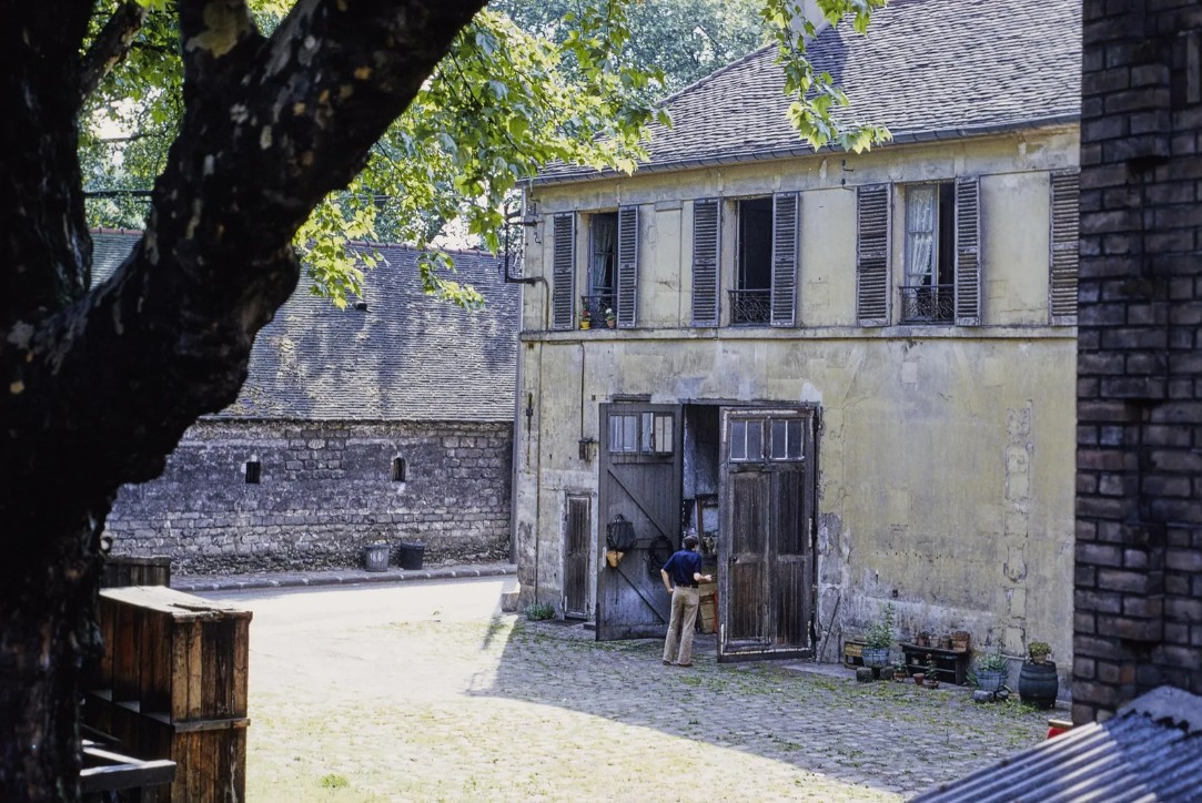
The green growing in the rail lines in the photograph below suggests disuse. The sign on the building to the left reads Warcollier & Loury, a latecomer of a company, active only between 1957 and 1986. The blue van on the right bears the name of Raki Duze, a Turkish anise. (This is visible only when you zoom in on the original photo at Paris 1970.)
Text by Philippa Campsie. Images of the Chateau de Bercy and Barrière de Bercy: Wikimedia. Maps, photos of wine tanker and 1910 flood: Gallica; Doisneau postcard: Paris Museums collection; pictures of modern-day Bercy Park: Norman Ball. Other images from Paris1970.
* Jean-Paul Clébert, Paris Vagabond, translated by Donald Nicholson-Smith, New York: New York Review Books, 1981 (first published 1952), pages 255–256.
** Lionel Mouraux, Bercy au fils du temps, Paris: Le Point, 2004.







Thank you!! Love reading your writings!! God bless, C-Marie
Thank you so much. I am glad you enjoyed the story. I found the 1970 photographs very touching. Best, Philippa
Many thanks for another fascinating post about this wonderful city! When visiting the Cinémathèque française I had no idea that it occupied part of an area with such an interesting past. There are still some industrial buildings to the south of Rue des Pirogues de Bercy with remnants of railway tracks which look as though they could have been wine warehouses.
Thank you for pointing that out. A few warehouses remain on the Cour St-Emilion, now used as boutiques and restaurants. Perhaps the industrial buildings you mention are part of that group. It’s such an interesting area.
I delight in these captured histories of the villages that made up Paris. And the maps, those representations in miniature of a different quotidian. Have you ever done a post on the drafters of Parisian maps?
Hi Wendy, That’s a good idea. I can spend hours looking at historic Paris maps. I even own a few, bought at flea markets. Stay tuned. Philippa
Thank you, once again, for a fascinating look at the history of Paris. In Georges Simenon’s late novel (1970) Maigret and the Wine Merchant, the merchant’s warehouses are in Bercy. I see now that Simenon’s description of the district was outdated by the time the novel was published. Marsha Huff
Hi Marsha, I know what you mean. I read an interesting book by Jean-Baptiste Baronian, “Le Paris de Simenon,” in which Baronian notes that Simenon spent a few years in Paris at the beginning of his writing career in the early 1930s. He then moved around from place to place. So when Simenon writes about Paris, he is writing about the city as he knew it in the 1930s. He never updated his view of the city. It explains a lot. Best, Philippa
Thanks for this nice reading. You could probably add a chapter about Bercy’s night life when it was deserted. The abandoned buidings were famous meeting places for free parties. I remember spending a night at the guardian office after having been caught rambling with friends in the middle of the night. We could hear the guy coming from a long distance as he was walking with a wooden leg. In fact after the official “procès verbal” that consisted in adding our names on an old book, he offered a glass of wine glad to have a talk during his service !
Dear Philippe, I love this story! It sounds as if you could write your own memoirs of your time in Paris! You must have had quite a few adventures. Best, Philippa
Chère Philippa,
merci pour ce très intéressant post.
À la fin du XVIIe siècle Louis XIV alla entendre la messe à Paris, je crois à Saint-Paul Saint-Louis. Au moment où s’agenouillaient les fidèles, le roi en aperçut un dressé. Furieux, il ordonna de le faire mettre à genoux. Le bedeau revint effaré : — Sire, il est à genoux, c’est un géant. Il s’agissait du seigneur de Bercy.
Je crois avoir lu ça jadis dans Saint-Simon.
Amitiés.
P
>
Cher Patrice, Merci. Je ne connaissais pas cette histoire. Oui, probablement Saint-Simon. Il faut chercher d’autres détails du seigneur de Bercy. Amitiés, Philippa