According to an old proverb, “Good fences make good neighbours.” It may or may not be true. But do good walls make good cities? Or, more simply, do walls help make cities? It seems that a wall built during the reign of Philippe II, known as Philippe Auguste, may have helped Paris become the city it is now. Or maybe that process started earlier, with a wall that archaeologists are just beginning to discover.
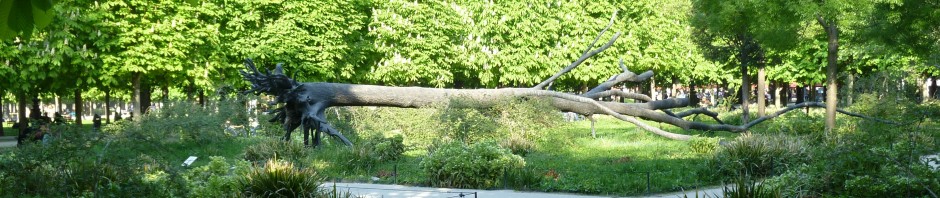
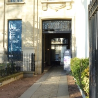
I knew of Philippe Auguste’s wall, because we had seen the part that is still visible in the Marais. A few years ago, we rented an apartment nearby and we used to pass the wall and the sports ground in front of it on our way to and from Monoprix and the Village St-Paul.
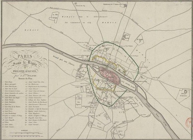
 More recently, I found a map dating from the 1820s showing Paris under the reign of Philippe Auguste that was published in Histoire physique, civile et morale de Paris depuis les premiers temps historiques jusqu’à nos jours, by Jacques Antoine Dulaure.
 I realized I knew nothing of the king who had a name like mine. So I went looking for him.
Philippe II succeeded to the throne of France (at that time a much smaller entity than today’s republic) in 1180. He was considered a pretty good king as kings go, but his track record as a husband is dismal. His first marriage was contracted when he was 15 and the bride, Isabelle of Hainault, was 10 years old. He didn’t take to her, and was on the point of seeking a divorce from her until somebody gently reminded him that if he did that, he would have to give back her dowry (it consisted of rather a lot of land). This argument made an impression, and Isabelle stayed. She bore him a son and died in 1190.
Shortly thereafter, Philippe went on the Third Crusade with Richard the Lionheart of England (when Richard was imprisoned and Philippe did not come to his aid, the former allies became deadly enemies – but that’s another story). On his return from the Holy Land, Philippe married Ingeburg of Denmark. Nobody knows what happened on the wedding night in 1193, but the very next morning, he sent her away. He took another wife (or concubine) called Agnes de Méranie, who went on to bear him two children.
The pope was furious and ordered the closing of all churches in France to force Philippe to renounce Agnes and take back Ingeburg. Philippe refused and it was only the death of Agnes in 1201 that ended the standoff. Philippe eventually recalled Ingeburg as queen (although he still didn’t want her as his wife – you do wonder what on earth happened on their wedding night). Ingeburg put a brave face on it, reigned as queen, and managed to outlive Philippe when he died in 1223.
All of which has nothing to do with the wall. Unless Philippe built it to protect himself from irate in-laws.
Colin Jones, in Paris: Biography of a City, notes that the wall was never used defensively, since the city was never besieged while it was in place, but it was an important symbol and helped consolidate the city. As he puts it:
This was power architecture. It made Paris the most heavily – and the most conspicuously – defended military stronghold in western Europe… The choice of Paris as royal capital meant that the cronies and clients of the monarch became eager to establish themselves in the city… high courtiers built permanent residences.
Before this time, courtiers had tended to camp out – grandly, with servants and cloth-of-gold tents, but camping nonetheless. Now they were putting down roots.
Jones adds: “Building the wall was a way of inhibiting external expansion and stimulating the consolidation of undeveloped land within the walls.” Today this is known as growth management or urban intensification and is intended to combat suburban sprawl. Philippe was way ahead of the curve on that one.
The map shows plenty of undeveloped land to build on, as the wall enclosed vineyards (“vignes”) and farms (“terres en culture”). Note the route of the Bièvre – a canal has been built from its original route that empties near the Ile de la Cité. Apparently you can still see the archway under the wall that allowed the passage of the canal. Today it lies underneath a post office at 30 bis, rue Cardinal Lemoine.
There are a dozen or so gates (portes) and posterns (poternes), and four towers where the wall met the river – Tour de Nesle, Tour qui fait le coin, Porte Barbelle sur l’Eau (elsewhere called Barbeau), Tournelle. All gone now, although the name Tournelle persists in the name of a bridge.
This modern picture shows what the Tour de Nesle might have looked like.*
 But Philippe was not the only wall builder. If you look closely at the map, you can see something called the “Seconde Enceinte” (Second Wall) faintly traced in yellow on both sides of the river. One section is labelled “Accroissemt de l’Enceinte” (Enlargement of the Wall).
 Dulaure dates this wall to the early 12th century; other historians had suggested that it was built much earlier, at the end of the Roman period. To support his argument, Dulaure cites a poem containing a detailed account of the Viking raids on Paris in the 9th century and insists that if there had been a wall around Paris at the time, the poet would have said so. It makes sense.
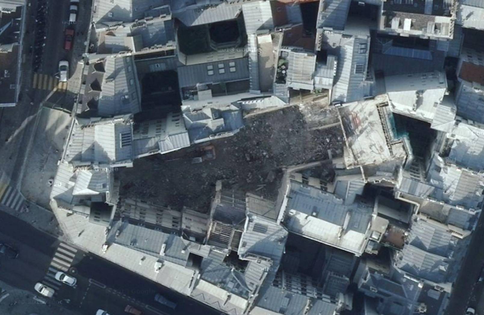
Colin Jones mentions a wall defending some of the churches on the Right Bank, but considers it a late Roman addition. My historical atlases do not mention or show this earlier wall. However, in 2009, the Institut national de recherches archéologiques préventives (INRAP) found traces of a medieval wall at the intersection of the rue de l’Arbre Sec and the rue de Rivoli in the 1st arrondissement.
INRAP calls it the “second wall” and dates it from the 10th or 11th century. There is a short video on the INRAP website showing the excavation. Here’s the Google satellite view. That’s the rue de Rivoli at the bottom.
 The archaeologist interviewed on the video notes that there is no documentation for the wall; nonetheless, starting in the 18th century, historians began to suspect the existence of a wall inside that of Philippe Auguste and had theories about its location and gates. Dulaure was one. And his instincts were right about the date.
Dulaure’s map also shows a second wall on the Left Bank as well as the Right. He has some evidence from documents about its location, which at its easternmost extent, is shown running alongside the canal de Bièvre. INRAP hasn’t confirmed this part yet, but my money’s on Dulaure. I’m sure it’s there.
Maybe, just maybe, this was the wall that helped start Paris on what Colin Jones calls “the greatest quantum leap in the history of Paris, before or since. Not much more than a dot on the map even in 1100, by the end of the twelfth century it was the largest city in Christendom and a pre-eminent cultural and intellectual centre.” Perhaps this medieval enclosure played a role far larger than anyone imagines.
Text by Philippa Campsie; photograph taken in the Marais by Norman Ball. Map images from Gallica, satellite view from Google Earth, painting of the Tour de Nesle from Wikipedia.
This website has a complete list of the remaining pieces of the Philippe Auguste wall that are still visible.
*The name of the Tour de Nesle was immortalized in another royal scandal 100 years after Philippe Auguste’s reign, as the site of adulterous assignations between the daughters-in-law of the king (Philip IV) and their lovers. When these liaisons came to light, the men were tortured and executed and the women were imprisoned. In the 19th century, Alexandre Dumas turned this event into a play called La Tour de Nesle.
Sources: John W. Baldwin, Paris, 1200, Stanford University Press, 2010; Colin Jones, Paris: Biography of a City, Penguin, 2004.


Thank you, yet again, for a wonderful piece of Paris’ history. Your articles add to my enjoyment of Paris as I walk her street each time I return, usually twice a year for a month. I have never seen the remaining piece of the wall In the Marais, but will look for it this trip.
Shannon
Very interesting article and nice clear maps. I urge your readers to go to the web site on Philippe-Auguste wall pictures. Its very interesting to view what remains in Paris. I like the picture of the apartment on 34 rue Dauphine where a portion of the wall is incorporated into the wall of the apartment.
Pingback: Borders, boundaries, and snails | Parisian Fields